Drone/UAV Research
Barrier Island Geomorphology and Vegetation Dynamics
Primary Researchers: Shane Daiek and Shane Nichols-O’Neil
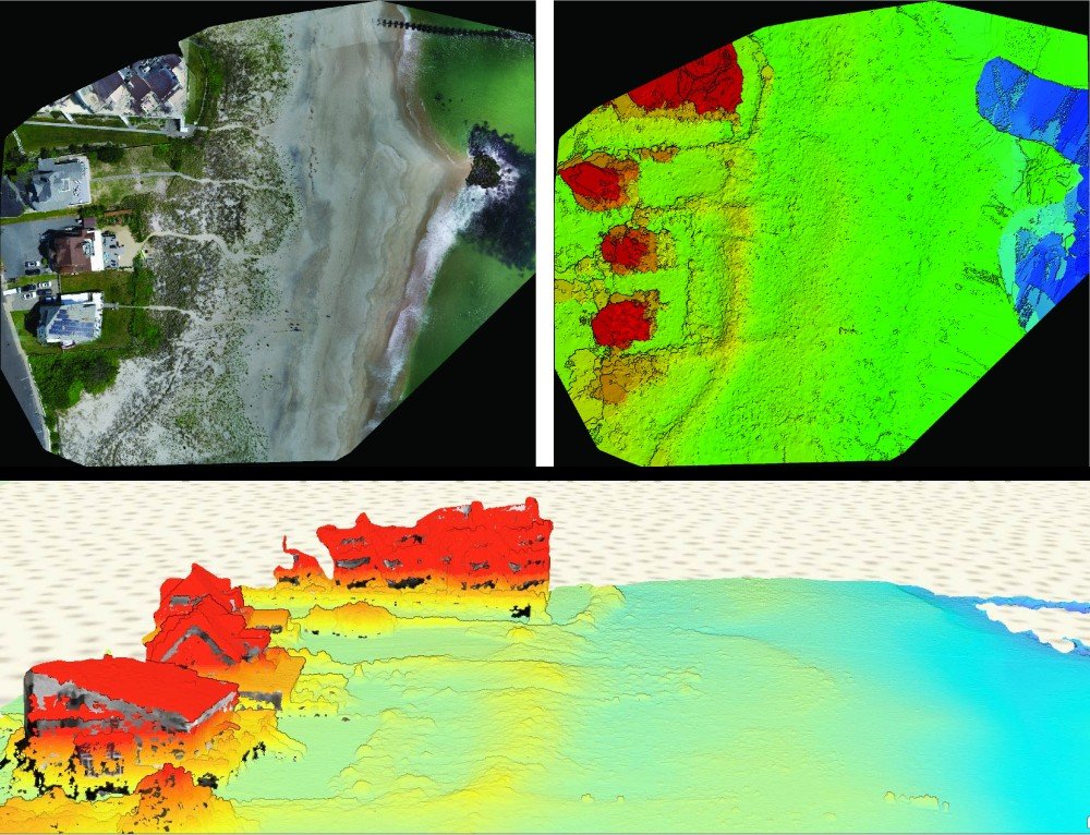
Shane Daiek’s current research focuses on the geomorphology of berm-dune structures in the State of New Jersey. His research is aimed to use the remote sensing tools of Unmanned Aircraft Vehicles (UAVs or Drones) to evaluate the role of vegetation as a sediment trapping mechanism that drives the morphology of coastal dunes. The data collected from various passive and active sensors attached to these aircraft (i.e., multi-spectral, orthomosaic imagery, and LiDAR) will help to quantify the interplay between berm-dune and the role vegetation has on the system’s evolution. Shane D. is a licensed FAA Part-107 Pilot.
Shane Nichols-O’Neil’s current research is more heavily focused on using the department’s LiDAR equipment to quantify berm-dune sediment fluxes as a proxy of accumulation (i.e., aeolian sediment fluxes) and erosion. Shane N. has an extensive background using Geographical Information Systems (GIS), specifically ESRI products, a key component of the research team’s data analysis.
These tools and techniques will provide useful data for a coupled berm-dune model that will help to better understand what key factors drive geomorphic change in these coastal environments.
Additional work: Currently working in collaboration with researchers at the USACE and USGS, where a model is currently being developed for barrier island evolution in Fire Island, NY during storm events and recovery periods.